 Click To Enlarge
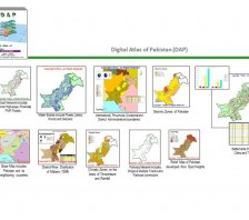
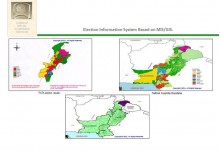
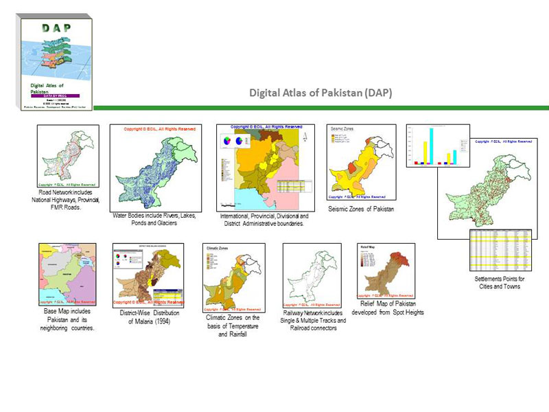
Digital Atlas of Pakistan, GIS coverage of entire Pakistan at Patwar Circle
BACK TO PROJECTS
Name of associated firm :
-
Project Location within Country:
Pakistan (Area 87, 7753.375 Km²)
Start Date:
January 1999
Completion Date:
November 1999
Project Description
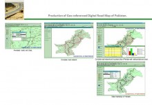
ECIL has developed Digital Atlas of Pakistan (DAP) as the appreciation out-of-box-solution. ECIL received the International Award special Achievement in GIS award1999, from the Environmental System Research Institute ESRI, California U.S.A.
DAP is a comprehensive, vectorised, Geographic Information System (GIS) of Pakistan. A first product of its kind in Pakistan captured at 1:1,000,000 scale. DAP consists of geographic attribute and textual data that can be accessed, queried, manipulated, displayed and modified with the help of Arc/Info®, ArcVIEW® and Arc Explorer® GIS Software.
Following coverages are included in DAP Version 1.2
-
Base map
-
Grid (Latitudes and longitudes)
-
Provinces
-
Languages of Pakistan
-
Divisions
-
International Boundaries
-
Districts
-
Rivers (Polygons)
-
National Assembly Constituency
-
Climatic Zones
-
Provincial Assembly Constituency
-
Road Network
-
Cities & Town
-
Rivers (lines)
-
Population
-
Annual Rainfall
-
Seismic Zones
-
Railway Lines
-
Spot Elevations
-
Cities Boundaries
-
Contours


