 Click To Enlarge
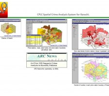
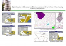
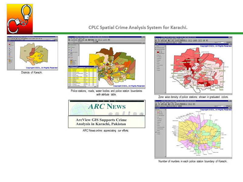
CPLC Spatial Crime Analysis System for Karachi
BACK TO PROJECTS
Name of associated firm :
-
Project Location within Country:
Karachi City
Start Date:
1998
Completion Date:
1998
Project Description
This Project has been funded by UN for Citizens Police liaison Committee (CPLC). The assignment called for development for Geo-Coded FIRS, Integrated with the Digital Street Map, Digitized from Guide Book of Karachi, Captured at 1:10,000 scale.
Services
-
Produce Digital Street Map of Karachi by Digitizing Karachi Guide Book and Integrated with GO Coded FIRs, containing following information and landmarks.
- Visiting places
- Plots and apartments
- Fire brigade stations
- River
- Banks
- Foreign missions
- Nala
- Hotels / Restaurants
- Government colonies
- Railway tracks
- Industries
- Insurance companies
- Roads
- Parks
- Libraries
- Graveyards
- Marriage Gardens
- Market and shopping centres
- Settlements
- Racecourse grounds
- Rest house
- Playgrounds
- Office building
- Welfare offices
- Stadiums
- Railway stations
- Worshipping places
- Hospitals Post offices
- Federal government offices
- Swamps/Marshy area
- Police stations
- Universities and boards
- Airports
- Travel agencies
- Sindh government office
- Cinema houses
- Clubs
- Railway booking agencies
- Educational institutes:
- Auditoriums
- Dispensaries
- Schools & Colleges -
Additional Data Incorporated
- Major roads
- Railway track
- Goths with names
- National Highway
- Rivers with names
- Few settlements with names
- Super Highway
- Nalas with names
- Creeks


