Digital/Computerized Topographic Survey and Feasibility Study for exploration of Corridors for Line Routes, Preparation of Plan, Profile and Tower Spotting for Four to Five 765 KV Transmission Lines from Bunji to Basha Dam Site to Manshera
BACK TO PROJECTS
Name of associated firm :
M/s BARQAAB Consulting Services (Pvt) Ltd - M/s Pakistan Engineering Services (Pvt) Ltd (PES) - M/s Engg. Agriculture Services Entity-Pakistan (EASE)
Project Location within Country:
NWFP Province and Northern Areas
Start Date:
September 01, 2005
Completion Date:
Ongoing
Project Description
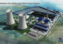
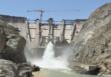
Consultancy Services were procured to carry out feasibility study for identifying and evaluation of the potential transmission line corridors to implement an effective power dispersal scheme for the major hydropower projects envisaged in Pakistan Power Generation Vision 2025. The project entails comprehensive study using latest remote sensing technologies on GIS platform and subsequent verification and generation of longitudinal and cross profiles through physical field survey and Digital Elevation Model. The project in itself is a challenging task as it required identification of optimal and feasible corridors through high relief mountains reaches and confining valleys which includes identification of switch yard locations for the proposed power plants in Indus and Kunhar river valleys including Basha Dam Site location.
Services
-
Identification of 765 KV Transmission Lines Routes connecting Manshera to Bunji through Indus and Kunhar river valleys
-
The project requires GIS based studies using remote sensing technologies using high and low resolution satellite imageries and digital elevation data
-
The physical topographic survey was also required to generate the longitudinal and cross section profiles of the selected corridors for the transmission lines using topographic data in GIS digital format
-
The survey also requires identification of optimal switch yard location for the proposed power generation plants in the area and its integration in GIS
-
Transmission Lines Tower spotting locations were also required to use high resolution satellite imageries and subsequent verification through field survey
-
ECIL also developed comprehensive Environmental and Geological assessment on a GIS platform which substantiates major requirement for feasibility of the transmission line corridors
-
The Associates M/s BARQAAB and PES - EASE-PAK also provided technical support and assessing the power dispersal scheme